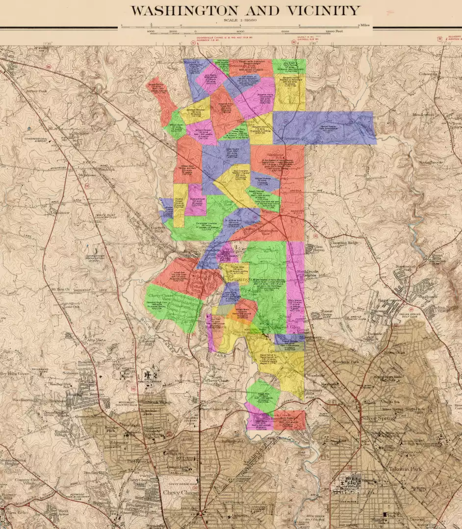
Maryland map with approximate locations of the first major subdivisions of The Hermitage and Joseph’s Park
In 1689, two tracts of land on the east side of Rock Creek named The Hermitage (3866 acres), and Joseph's Park (4220 acres) were granted to William Joseph. In 1705, William Joseph Junior sold the tracts to James Butler. The two tracts remained largely intact until Jame's son Thomas Butler began leasing or selling typically 100-200 acre plots to tobacco farmers and larger plots to land agents between 1737 and 1755. This map shows approximately where most of these initial smaller plots of The Hermitage and Joseph's Park were located on a 1944 topological map of the region.
The placement of the plots on the map is based on the metes and bounds and various other features (creeks, hills, roads, etc.) described in the deeds and surveys from the Maryland Land Records. As far as I know, this is the first map to show the approximate locations of the first sub-developments of The Hermitage and Joseph's Park.
Click the map for a larger version that can be further enlarged by clicking it. Use your browser Back button to return to this page.
Email your comments or suggestions please.
The base map was obtained from the Library of Congress website:
https://www.loc.gov/item/87693081/
Map Title: Washington and vicinity, Maryland, District of Columbia, Virginia
Contributor Names: Geological Survey (U.S.)
Created / Published: [Washington, D.C.] : Dept. of the Interior, U.S. Geological Survey, [1944]