Ring of Fire
When talking about volcanoes, the fact that many of them occur at the periphery of the Pacific Plate is often mentioned. Take a look at the map of the Pacific Plate below, then look at the Google Map of volcanoes. You'll see that the Google map shows volcanoes aligned with the borders of the Pacific Plate and the minor tectonic plates along its periphery.
A good example of a minor tectonic plate is the Okhotsk microplate that covers the Kamchatka Peninsula, Sakhalin Island, and regions of northern Japan. The boundary between Okhotsk microplate and Pacific plate is a subduction zone, where the Pacific plate subducts beneath the Okhotsk Plate. The Kuril Islands are along that boundary.
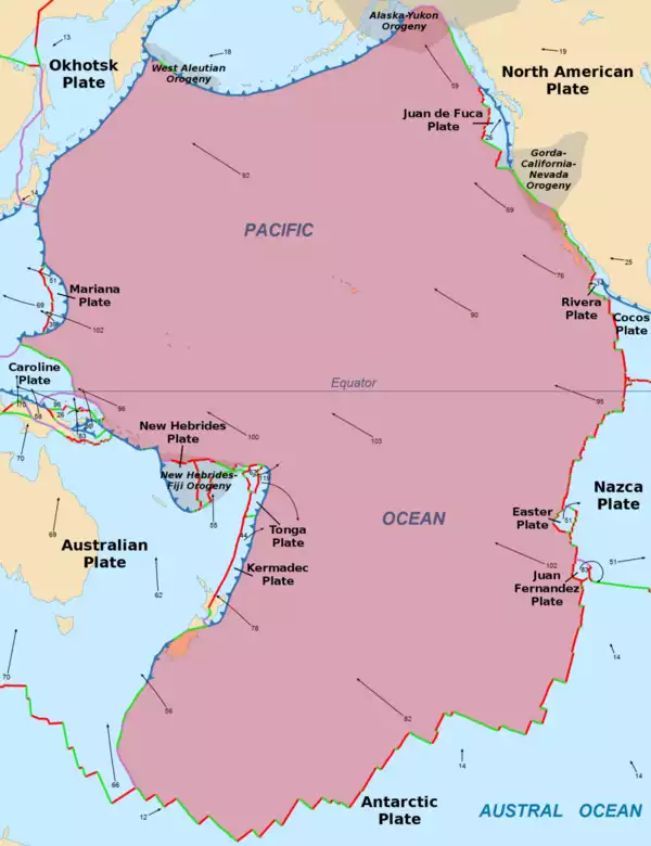
graphic by Alataristarion
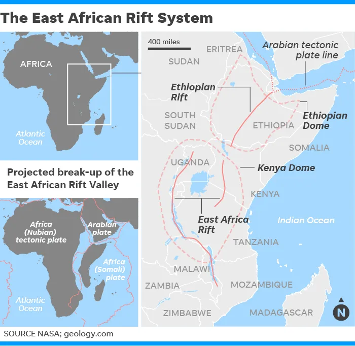
East African Rifts
The East African Rift and the Ethiopian Rift exist at the boundaries of the Nubian, Somali, and Arabian plates. These plates are moving apart, a process known as rifting. This process is slow, with the Arabian plate is moving about one inch per year.
Eventually, the Gulf of Aden and the Red Sea will flood into the rift. Over time, this is expected to break Africa in two, creating another continent and an ocean between them. The smaller (easterly) continent will include present-day Somalia and parts of Kenya, Ethiopia, and Tanzania.
There are volcanoes along the rifts. Stratovolcanoes Mount Nyiragongo, Visoke, Rungwe, Kyejo and shield volcano Nyamuragira are along the western part of the East African Rift. There are numerous volcanoes in Kenya along an area named the Kenya Dome.
Geothermal Energy
Volcanoes are sources of heat, and numerous organization are now building power plants to harvest that energy. One example is WKP Gunung Sirung, that started building a geothermal power plant on Indonesia's Pantar Island.
You can get up-to-speed on global geothernal power generation from the Global Geothermal Power Tracker.
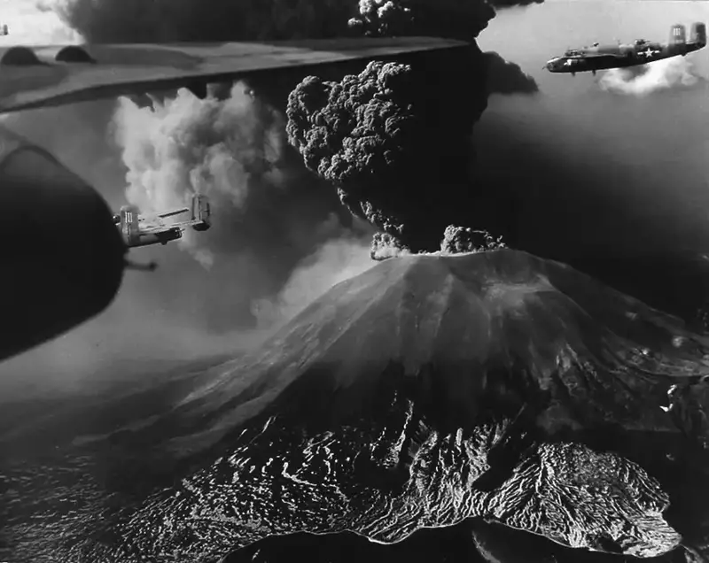
World War II and Volcanoes
Volcanoes played a part in World War II. The article, Mount Vesuvius Eruption of March 1944 has numerous photos, such as the one below, of how this eruption was disruptive to the war effort.
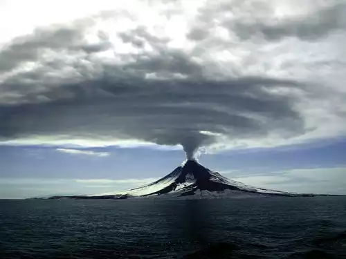
During WWII, the United States and its allies were at war with Japan in the Pacific. The war involved Japan capturing and trying to hold Pacific islands. The vast majority of these islands were formed by volcanoes.
In particular, the Aleutian Islands and the Kuril Islands were all formed by volcanoes. Pilots who flew patrols in PBY Catalinas and PV-1 Venturas, and bombing missions in B-24s, B-25s, and B-26s, had to be careful to not run into a tall volcano in the notorious bad weather, and low-visibility in the Aleutians.
List of Current Eruptions (Smithsonian)
Further reading
Wikipedia: Geologic time scale