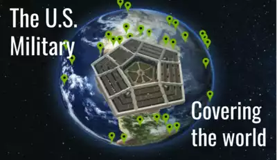
During the presidential campaign of 2012, candidate Ron Paul said that we had “thousands of military bases overseas” and that we should close down some of them to take care of things at home. I thought that thousands was an exagerration. I did research but no source convinced me that they had the correct number of overseas bases. To find out for sure, I had to count them myself. So, I built a geographic dataset of all the U.S. military fixed property assets (bases and other things) that I could find. And not just current assets, I collected every one I could find going back to the founding of the country. It took years. Today, it's complete-enough to use.
Turns out, Ron Paul did exagerrate–but only by a factor of about two. Not bad given that today's politicians exagerrate by far greater amounts. The dataset has 5,700 items today; Most items are land, naval, and air bases. In the first 150 years of the country, these were forts, coastal batteries, and calvary remount stations (horses), with no overseas bases. Today, our military inventory is replete with foreign properties.
The types of assets are more varied now than in the early years. We have radar installations, communications transmiters and antennas, satellite base stations, weapons storage (nuclear and not), veterans hospitals and national cemeteries, and missile installations (lots of missile installations!) both at home and overseas.
The map below displays about 4,092 markers. I update the list regularly as I find historical assets and those get shown in the map automatically. I left out 1,308 intercontinetal ballistic missile silos and the veterans facilities. Maps of these are available separately. I was worried that I'd crash your browser or Google would get upset with a map of so many markers. Oh, the map is a Google map so you can zoom in and see the actual satellite view. Thanks, Google.
The blue markers are for current assets and the red are for those that are not current. Many of these non-current assets have been transferred to local governments and to the private sector. We have the military and World War II to thank for most of our commercial airports–they started out as military airfields. The radars that keep us safe when we fly were installed by the military during the Cold War and later transferred to the FAA. The bases we no longer use in other countries were similarly transferred and are in use today.
Environmental Issues
But don't get the idea this this reuse from World War II spending is continuing today. Today's military spending isn't helping our civilian infrastructure like it once did. Also, there's a dark side to military spending (both past and present) as well. It's environmental impact. Military sites make up a huge chunk of all EPA Superfund sites. There are external costs to the military, often called an externality, that we don't see reflected in military budgets. Environmental cleanup is just one of them.
Note: You can download a poster of the Superfund sites.
If maps aren't your thing, a long list of these assets, sorted by country, then name, is available here.
Help using Google Maps
The Full Screen control in the upper righthand corner of the Google Maps display expands the display to cover the entire computer screen. This full-screen feature is not available on Apple IOS devices like the iPad.
You can exit out of full screen by pressing the Escape key or clicking the control in the upper righthand corner of the display.
The Map/Satellite control in the upper lefthand corner of the screen lets you choose either the normal map view or the satellite view. The satellite view allows you to see the actual military facility when you zoom in. You can choose to turn Labels on or off. The labels are the names of places, businesses, cities, etc. that appear on the map. You can turn off the labels if they obstruct your view.
When you select the Map view, you can turn on terrain features by clicking or touching the Terrain box. This will show things like mountain ranges, similar to looking at a relief map.
You can zoom in and out in a few ways. If you're using a mouse with a scroll wheel, the wheel controls zooming. If you're using an IOS device like an iPhone or iPad, double-tapping the display zooms in but tapping does not zoom out.
Most touch screen devices will zoom by pinching the display with two fingers.