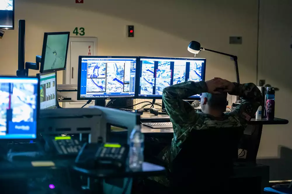
The United States patrols its borders using technology that includes helicopters, aircraft, drones, aerostats (unmanned tethered blimps), cameras, radar, and more. When we see Customs and Border Protection (CBP) agents in the field in their white trucks and on foot, know that there are more sitting in command centers watching screens.
The vast majority of resources are directed along the southern border.
The Biden Administration's 2024 proposd budget includes about $24 billion to U.S. Customs and Border Protection (CBP) and Immigration and Customs Enforcement (ICE). It’s a nearly $800 million increase over the 2023 budget.
We've been spending similar amounts each year on protecting our borders EVERY YEAR for years. What has that money bought us? This project attempts to answer that question by showing you the hardware and systems that are in place now.
Thank you to the Electronic Frontier Foundation for releasing the locations of CBP towers in the Southwest. We had fewer than 30 before that.
Help using Google Maps
The Full Screen control in the upper righthand corner of the Google Maps display expands the display to cover the entire computer screen. This full-screen feature is not available on Apple IOS devices like the iPad.
You can exit out of full screen by pressing the Escape key or clicking the control in the upper righthand corner of the display.
The Map/Satellite control in the upper lefthand corner of the screen lets you choose either the normal map view or the satellite view. The satellite view allows you to see the actual military facility when you zoom in. You can choose to turn Labels on or off. The labels are the names of places, businesses, cities, etc. that appear on the map. You can turn off the labels if they obstruct your view.
When you select the Map view, you can turn on terrain features by clicking or touching the Terrain box. This will show things like mountain ranges, similar to looking at a relief map.
You can zoom in and out in a few ways. If you're using a mouse with a scroll wheel, the wheel controls zooming. If you're using an IOS device like an iPhone or iPad, double-tapping the display zooms in but tapping does not zoom out.
Most touch screen devices will zoom by pinching the display with two fingers.
 Aerostats
  Cameras
  Drone base
 CBP Station
Cameras
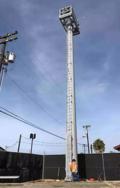
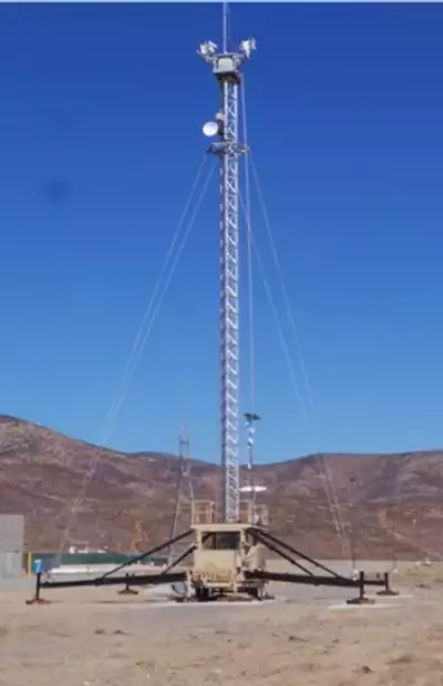
There are about 350 towers along the southern border with Mexico equipped with cameras (visible light and infrared) that are remotely controlled. Some of those cameras are installed at checkpoints along highways in the U.S. Southwest.
There are plans to install about 400 more, with some along the northern border.
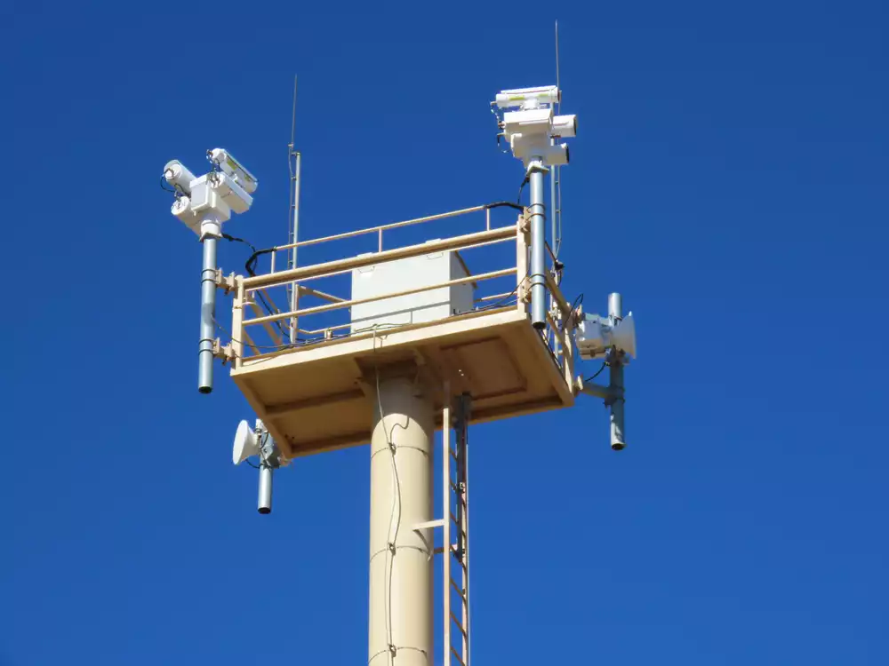
The equipment installed on the towers are made by Elbit Systems of America, General Dynamics, and Anduril Industries. The Elbit Systems product is Integrated Fixed Towers (ITF). The General Dynamics product is Remote Video Surveillance System (RVSS). The Anduril product is Autonomous Surveillance Towers (AST).
These are the numbers of each:
| ITF | |
| RVSS | |
| AST | |
| Total |
The northern border also has cameras but far fewer. These cameras are part of the Northern Border Remote Video Surveillance System, which currently (Nov 2023) has 22 sites.
Towers
Drones
CBP operates a fleet of nine MQ-9 Reaper drones to patrol the northern and southern borders. These deploy from airbases in San Angelo, Texas, Sierra Vista, Arizona, and Grand Forks, North Dakota.
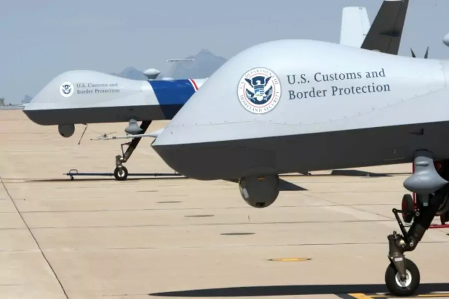
Those “bubbles” at the bottom of the drone are forward-looking infrared (FLIP) cameras made by Teledyne FLIR LLC of Wilsonville, Oregon.
It's been reported that Reaper drones each cost about $12,255 per flight hour, but that doesn't include the costs of pilots, equipment, and overhead.
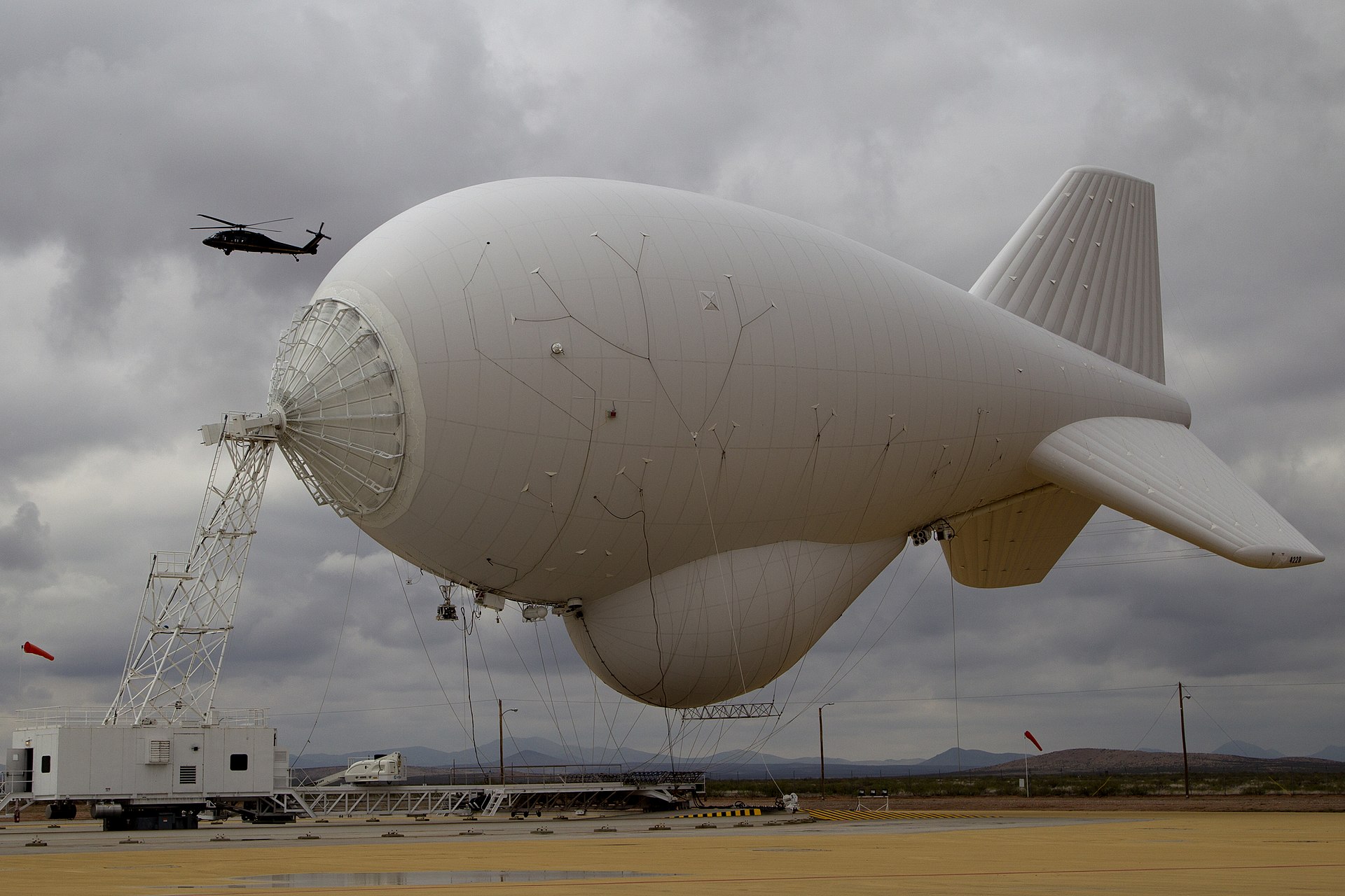
Aerostats
U.S. Customs and Border Protection uses tethered aerostats to monitor land and ocean for up to 200 miles. The aerostats can carry payloads that consist of Radar and cameras. The aerostats deployed for border protection are:
- Tethered Aerostat Radar System (TARS)
- TARS uses tethered aerostats as radar platforms. They were introduced in 1980.
- Persistent Ground Surveillance Systems (PGSS)
- High-definition imaging from Electro-Optical and Infrared cameras. It detects moving ground targets using radar, then has camera(s) point ot the target. The CBP has deployed one of these aerostats near Nogales, Arizona.
- PGSS aerostats are tethered to a mobile platform, so it may be moved.
Linear Ground Detection System
This system relies on buried fiber optic cables to detect movement that's relatively closeby. This table and the diagram below gives you an idea of the distances:
| Person walking | 10 feet |
| Moving vehicle | 50 feet |
| Surface digging | 30 feet |
| Tunneling | 30 feet |
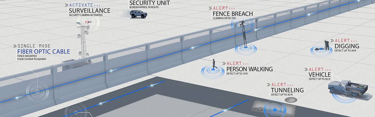
Very little of this technology has been deployed by the CBP so far.
St Lawrence River
The roughly 100 mile border between the U.S. and Canada (Ontario and New York) along the St Lawrence River has little CBP technology to detect intruders. CBP relies on the honor system. Aliens who cross by boat are expected to use a smartphone app named CBP ROAM.
Behind the scenes with Border Patrol catching illegal immigrants
Sources
EFF: CBP Is Expanding Its Surveillance Tower Program...And We're Mapping It
The Department of Homeland Security: Remote Video Surveillance System
Homeland Security: CBP- Remote Video Surveillance System (RVSS) Program
Homeland Security: Remote Video Surveillance System Upgrade Program
Wikipedia: Tethered Aerostat Radar System
Unmanned Aircraft System MQ-9 Predator B
Slate: Border Patrol Drones Each Cost $12K an Hour to Fly...
OFFICE OF INSPECTOR GENERAL Report
fiber-optic Linear Ground Detection System (LGDS)
EFF: U.S. Border Surveillance Towers Have Always Been Broken
Additional stories from ALC Press